Phirez Training Academy

Hands-on geospatial masterclasses, taught in the field

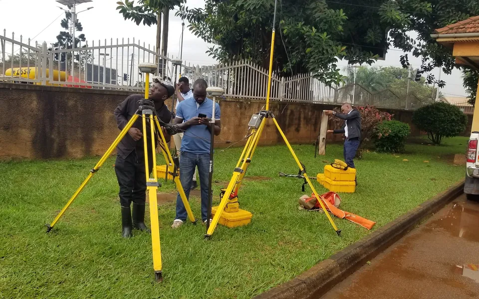
Equip your surveyors, engineers and GIS analysts with certified, practical competency. Classroom instruction is paired with real field exercises on genuine Trimble, DJI and Esri systems.

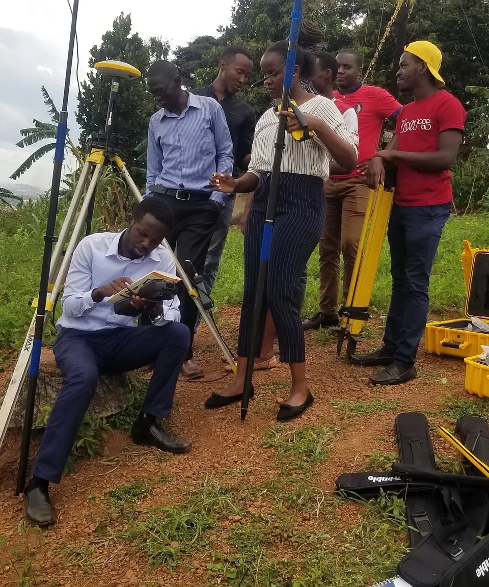
Trimble GNSS survey equipment being unpacked and demonstrated during a field training session overlooking Kampala.
Train on genuine systems Trimble GNSS & total stations, DJI Enterprise drones, Esri ArcGIS Pro
6Certified programs
2–5Days per program
KampalaOr delivered at your own site
BlendedClassroom and field learning
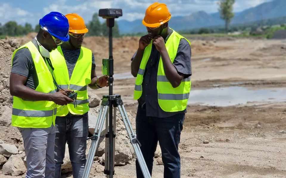
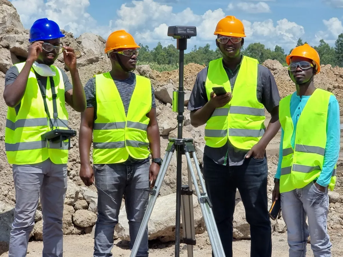
Survey team gathered around a GNSS rover for a topographic survey on an earthworks site. Real sites. Real instruments.
Why train with Phirez

Field-proven competency, zero guesswork

Unlike generic theoretical workshops, Phirez Academy courses are led by practicing survey engineers and GIS architects who actively execute national-scale geodetic and drone mapping contracts across Uganda.

01

Genuine modern hardware

Train on real Trimble R12i GNSS, S-Series robotic total stations, and DJI Enterprise RTK drones.

02

Real Ugandan datasets

Work with local UTM projections, Arc 1960 transformation parameters, and real Ugandan terrain data.

03

Recognized certificates

Receive certificates verifying hands-on practical competency upon course completion.

Curriculum

Core masterclass programs

Attend at our Kampala training center, or have us deliver a customized on-site program for your staff. Every course blends classroom instruction with live field practice.

3-Day Intensive
Survey & Positioning

High-Precision RTK GNSS & Total Station Operations

Master modern land survey workflows from static control networks to high-speed RTK stakeout using Trimble R12i receivers, S-Series robotic total stations, and Trimble Access.

  • Base and rover radio/cellular NTRIP configuration
  • Site calibrations, local coordinate transformations & geoids
  • Feature coding and linework creation in the field
  • Field troubleshooting and tilt compensation best practices
Kampala or on-site Inquire About GNSS Course
4-Day Masterclass
Aerial Mapping & LiDAR

Commercial Drone Pilot, Photogrammetry & LiDAR

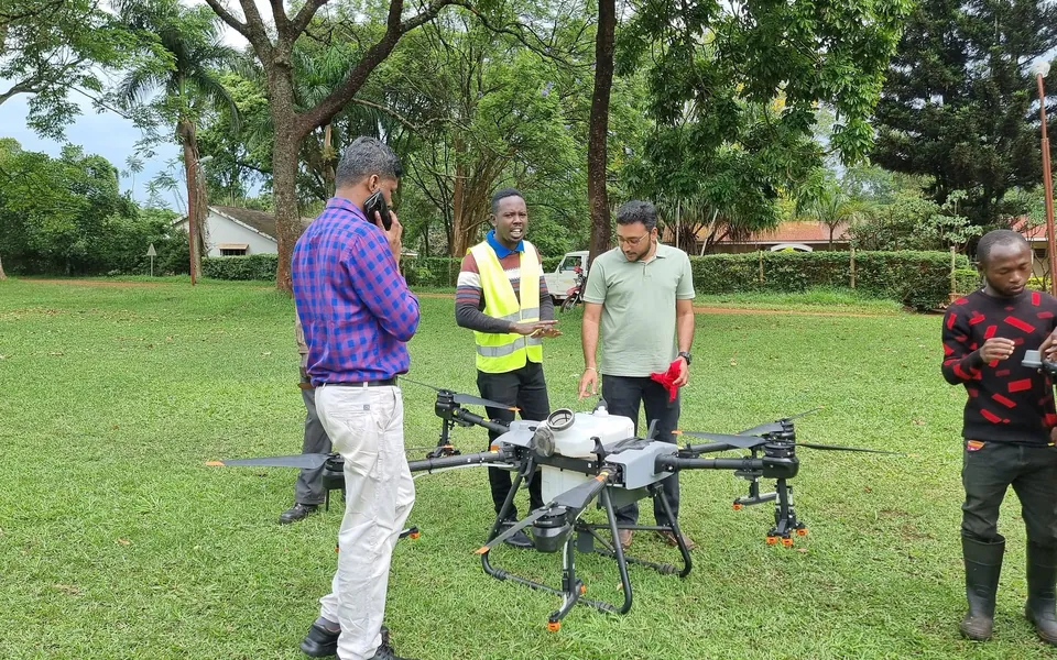
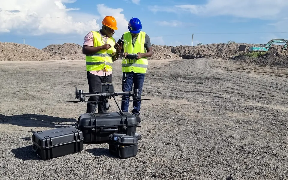
From flight planning and airspace compliance to point cloud classification. Learn how to deploy DJI Enterprise drones (Matrice 350, Mavic 3E) to produce survey-grade terrain models.

  • Mission planning: GSD calculation, overlap, RTK base setup
  • Aerial LiDAR point cloud processing with DJI Terra & TBC
  • Ground Control Point (GCP) and checkpoint placement verification
  • Volume calculations, contour generation & orthomosaic export
Kampala or on-site Inquire About Drone Course
5-Day Professional
GIS & Spatial Analysis

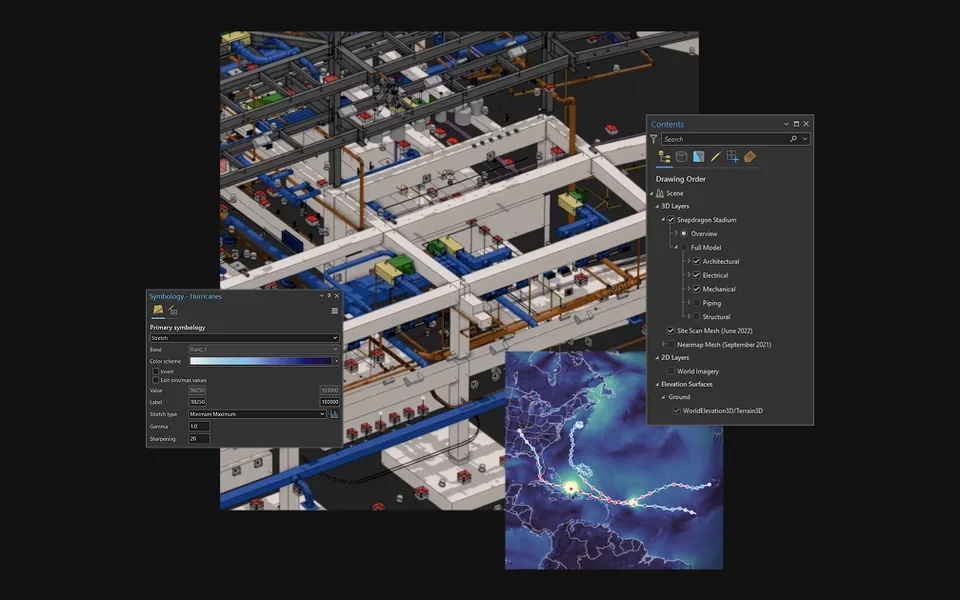
Esri ArcGIS Pro Advanced Spatial Analysis & SDI

An exhaustive masterclass in ArcGIS Pro: multi-user geodatabase management, advanced spatial statistics, model builder automation, and spatial data infrastructure architecture.

  • Advanced geoprocessing, raster analytics & hydrological modeling
  • Enterprise geodatabase topology and schema design
  • Web map publishing and dashboard configuration on ArcGIS Online
  • Python ArcPy scripting for recurring GIS tasks
3-Day Practical
Engineering Design

AutoCAD Civil 3D & Survey Data Integration

Connect field survey data directly to engineering civil design. Learn to import raw survey points, create dynamic surfaces, model road corridors, and compute earthwork volumes.

  • Survey database setup and description key management
  • TIN surface creation, breakline editing & boundary enforcement
  • Road horizontal/vertical alignment and corridor profiling
  • Automated cut/fill cross-section volume calculations
Kampala or on-site Inquire About Civil 3D
2-Day Workshop
Field Data Collection

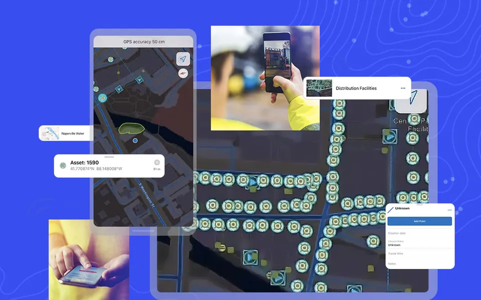
Mobile Data Collection with Field Maps & Survey123

Design and deploy smart offline survey forms with logic, photo attachments, and high-accuracy GPS integration to streamline field data collection across large remote teams.

  • XLSForm syntax scripting with dynamic skip logic & validation
  • Offline basemap caching and synchronization protocols
  • Bluetooth pairing with external Trimble GNSS receivers
  • Real-time executive dashboard generation
Kampala or on-site Inquire About Mobile GIS
Custom Corporate
Corporate Capacity Building

Tailored In-House Corporate Capacity Building

We build a bespoke curriculum aligned directly with your organization's projects, existing equipment, software licenses, and specific operational challenges.

  • Delivered at your headquarters, field base camp, or our Kampala lab
  • Customized course schedule fitted to operational shifts
  • Practical exercises conducted on your active project sites
  • Post-training assessment and ongoing HelpDesk support
Your site or our Kampala lab Request Corporate Proposal
How it works

From first enquiry to certified competency

A simple path for individuals and teams alike.

Enquire

Tell us who needs training. We send the latest course calendar, syllabus details, and group registration discounts.

Choose your setting

Attend at our Kampala training center, or have us deliver on-site at your headquarters or field base camp.

Learn by doing

Classroom instruction paired with field exercises on genuine equipment, led by practicing engineers.

Get certified

Leave with a recognized certificate verifying your hands-on practical competency.

Enroll today

Enroll your team in an upcoming session

Contact our Academy Coordinator to receive the latest course calendar, syllabus details, group registration discounts, or to schedule a customized on-site training.

Inquire About Courses Call: +256 783 549 770
info@phirez.ug 2nd Floor, Unicalo House, Plot 11, Archer Road, Kampala
Chat on WhatsApp